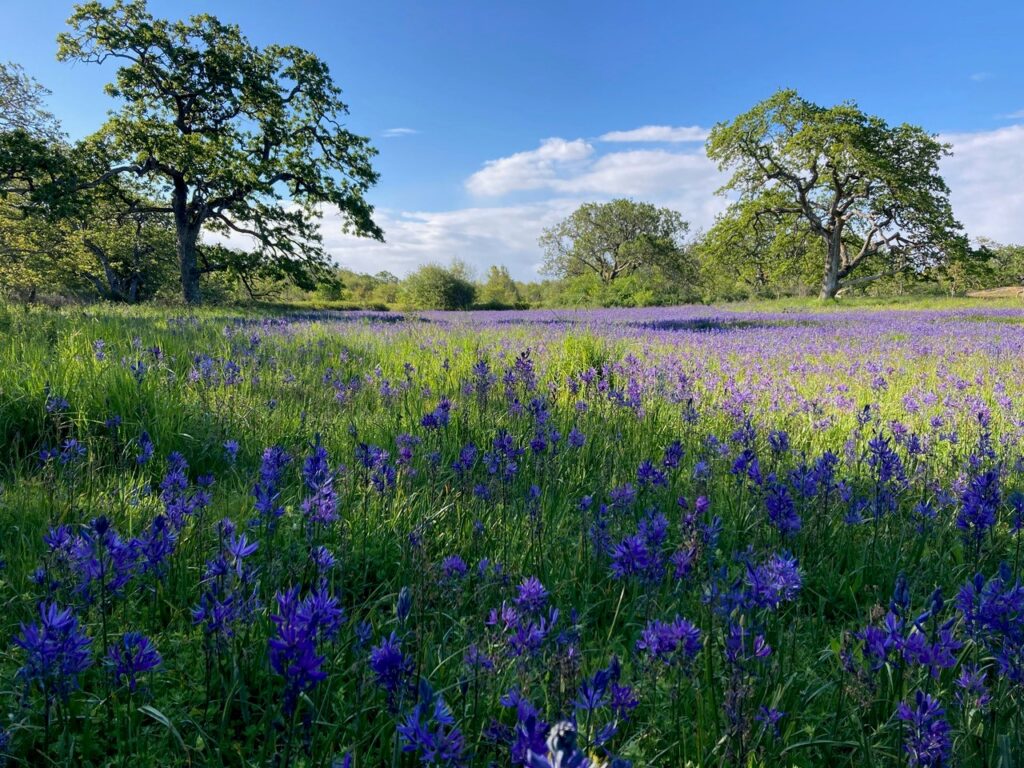
Earth Day is Wednesday April 22
Earth Day is Wednesday April 22! Oak Bay is home to many picturesque outdoor spaces,
21 April 2026
Easter Long Weekend Hours
Easter long weekend hours for Municipal Hall, Public Works and Oak Bay Recreation facilities.
31 March 2026

Proclamation – Purple Day
WHEREAS Purple Day is celebrated on March 26th annually, during Epilepsy Awareness Month, to increase
17 March 2026
Easter long weekend hours for Municipal Hall, Public Works and Oak Bay Recreation facilities.
31 March 2026
WHEREAS Purple Day is celebrated on March 26th annually, during Epilepsy Awareness Month, to increase the knowledge and understanding of epilepsy in the community…
17 March 2026
The Oak Bay Emergency Program (OBEP) has launched a community survey! We’re looking to strengthen services, programs and initiatives to support you and your family, ensuring Oak Bay is prepared and resilient in the face of emergency.
10 March 2026
Cycling improvements are coming to two new cycling routes in the District of Oak Bay, with construction starting on the Henderson and Haultain-Estevan Neighbourhood Bikeways.
3 March 2026
The District of Oak Bay is pleased to announce the 2025 Arts Alive People’s Choice Award winner, The Kiss by David Hunwick.
12 February 2026
Family Day long weekend hours for Municipal Hall, Public Works and Oak Bay Parks, Recreation and Culture facilities.
12 February 2026
As community members, we know how great our community is and can list off the many reasons we call Oak Bay home. Oak Bay’s received recognition worldwide as the Globe and Mail ranked Oak Bay the 12th most livable city in Canada.
2 February 2026
The District of Oak Bay welcomes Robbins as our new parking enforcement contractor. Residents will see Robbins vehicles and staff patrolling the streets to promote awareness for residents and visitors about our parking regulations.
1 February 2026
2025 has been a busy year for District of Oak Bay staff, working to serve our community. Below, you’ll find a few highlights from the year as we look forward to 2026.
19 December 2025
Below you’ll find holiday hours for District facilities. From our staff to you and yours, have a happy and safe holidays and happy new year!
19 December 2025
The District of Oak Bay has adopted an updated Official Community Plan (OCP), a future-looking framework that will guide land use decisions and infrastructure investments over the next 20 years, while ensuring Oak Bay meets provincial housing requirements. The document will next be reviewed in five years.
15 December 2025
In 2025, the Oak Bay Recreation Centre reached a historic milestone, 50 years of serving our community. Since opening its doors in 1975, the Centre has been a hub for recreation, wellness, and connection.
15 December 2025
A Public Hearing will be held at the Monterey Recreation Centre in the Garry Oak Room on Tuesday December 9, 2025 at 6:00 PM.
25 November 2025
Give back to those without homes this holiday season!
20 November 2025
See updates to our strategy following September’s public engagement and share feedback!
7 November 2025